Overview and Stats
The Grasshopper Fire was one of many fires in an unusually bad fire year for Oregon. The fire started on July 23rd with an assumed ignition from a lightning storm which moved across the region. The fire burned on the east side of Mt. Hood impacting federal, state, and private lands in Hood River and Wasco Counties. Over multiple weeks, it burned actively and grew to over 93,900 acres in size. At one point it was one of the highest priority fires in the country, with a peak of 1,900 people assigned. As of October 19, 2026, the fire is reported to be 98% contained.
Bark’s Statement on the Grasshopper Fire
The timber industry is exploiting the Grasshopper Fire to attack environmental protections, but environmental laws are not the problem. Bark has released a statement to clarify our stance and set the record straight.
Progression Map
Status Update
During suppression operations, 150 miles of dozer line and 20 miles of hand line were created, along with 150 miles of road prepared as containment lines (see map below). The suppression cost for this fire is over $130 million. The map below shows operations of the suppression efforts including fuel breaks and other actions.
Bark’s Concerns: Suppression Impacts
Wildfire suppression can cause a variety of impacts. Large bulldozers scrape off the topsoil to create fuel breaks. Large trees near roads can be deemed a hazard and felled. The images below are not comprehensive, nor are they necessarily intended to criticize, but rather, to show the reality of what an aggressive suppression policy looks like on the ground.
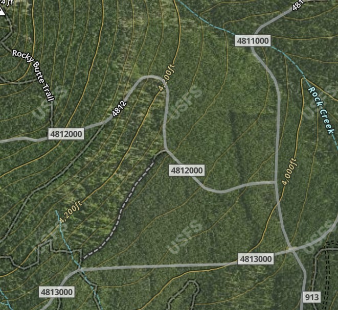
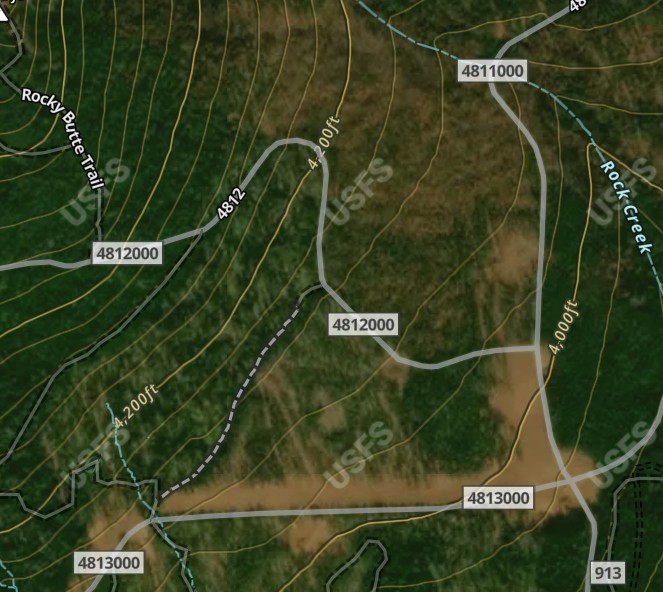
Road 4810, 4811, and 4813 Junction
- A very large “drop point” for trucks and heavy equipment was created at the road junction seen below. Some of what you see (small gaps and lines of cleared trees) was created during thinning operations that were ongoing as part of the Rocky EA.
Road 4860/Grasshopper Point
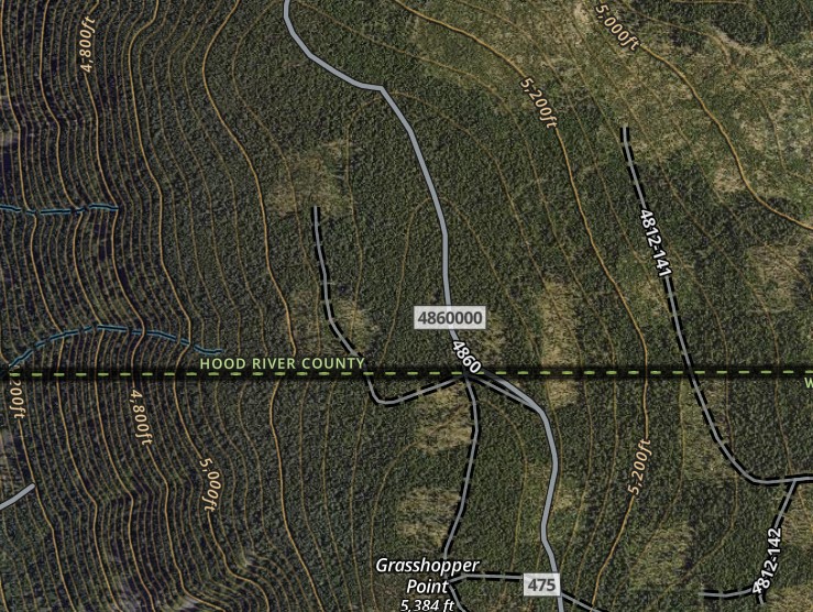
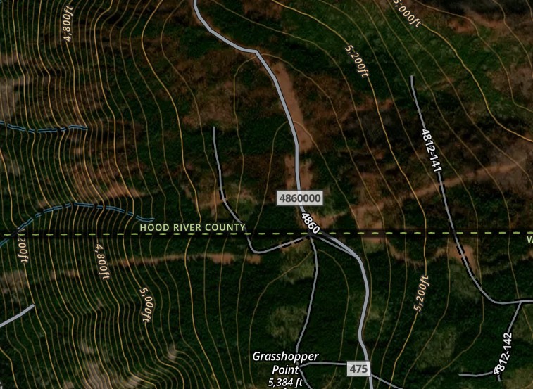
- Tethered logging operations created a fuel break down a steep slope into the Boulder Creek drainage off of the 4860 road.
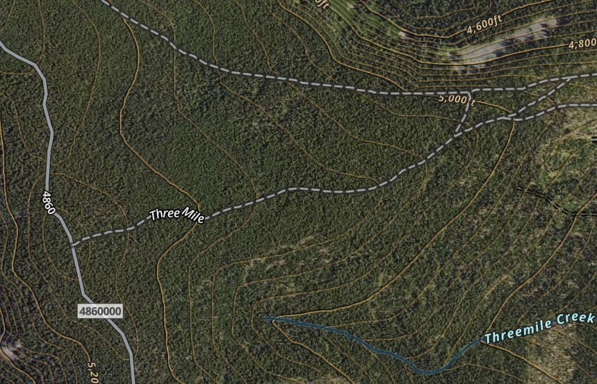
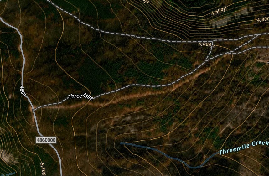
Road 4860/Three Mile Trail
- A dozer line was created on/adjacent to the Three Mile trail, starting at trail junction with road 4860.
Ecological Impacts
Background
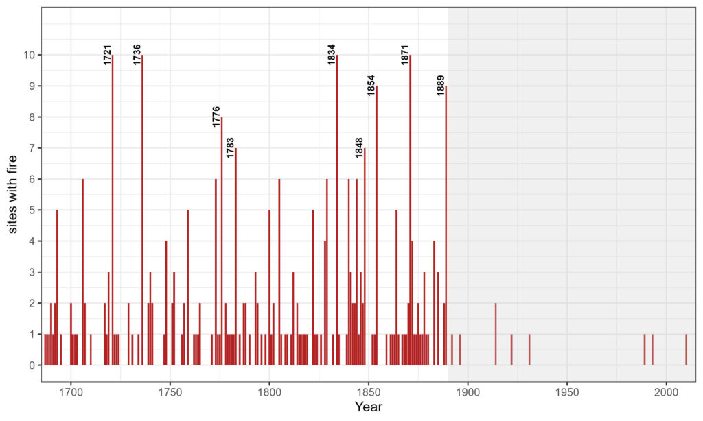
The forests of Mt Hood developed alongside fire and the complex interactions between climate, weather, topography, and vegetation. The area where the Grasshopper fire burned is no different. Ongoing fire history research on Mt Hood shows that the east side saw fire frequently over the last few hundred years. The onset of settler-colonialism and the removal of Indigenous land stewards dramatically reduced the frequency of fire on Mt Hood and across the continent. It is with this context that we should interpret the fire and its ecological impacts.
Burned Area Emergency Response (BAER) analysis
The BAER analysis is conducted by a team of resource specialists who use both geospatial and on-the-ground data to determine the impacts of a fire and identify immediate threats to human safety and watershed stabilization. The BAER analysis of the Grasshopper fire has been completed, though we are waiting for the full published data.
One of the analyses they complete is a determination of soil burn severity within the fire footprint. Soil burn severity can help indicate how forests may recover after wildfire; higher-severity burning can damage fungal networks and seed banks, delay regeneration, and increase erosion and runoff. 13% of the fire area was unburned or experienced very low soil burn severity, 58% low severity, 26% moderate severity, and 3% high severity.
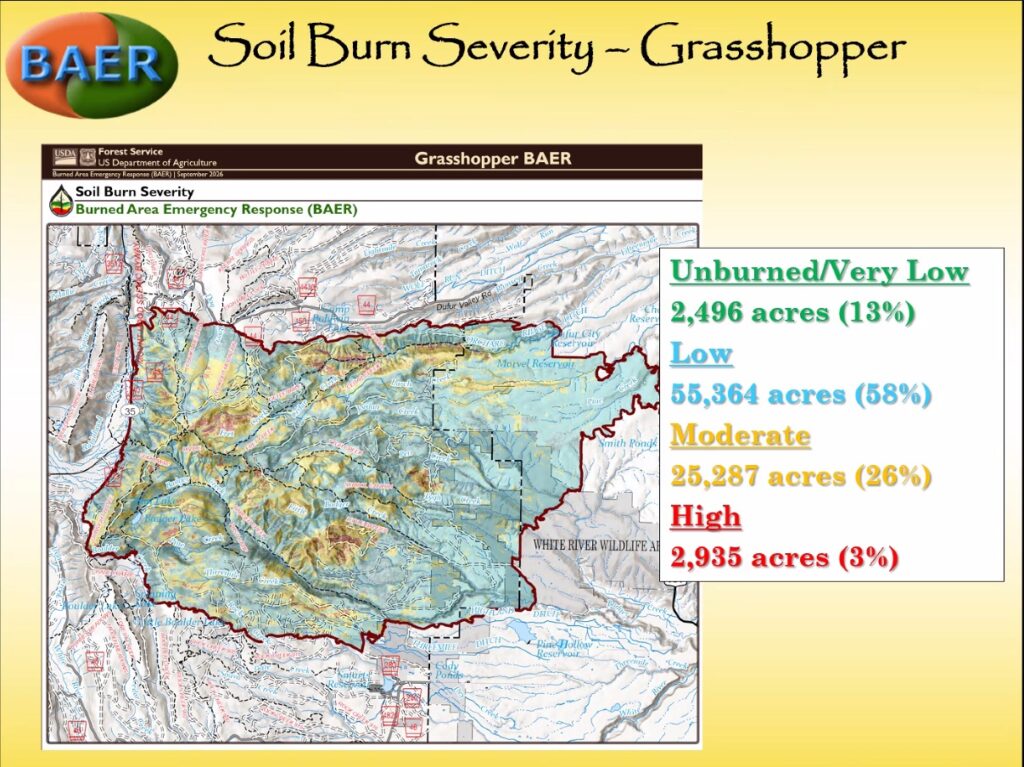
* Important note: The BAER report is an immediate and emergency analysis of the fire’s impacts. The data should be considered preliminary. The full picture of the fire’s impacts may take several years of further analysis to understand.
Policy Summary: NEPA Projects Impacted
There were a number of forest management projects that sat within the footprint of the fire’s burned area. Each of these projects will now have to undergo a review and likely a revision. Some of these project areas are up to 10 years old (Rocky EA) but still in the process of being implemented. Other projects had been fully approved but had only been partially completed prior to the fire.
- Grasshopper EA
- Rocky EA
- South Pen Insect and Disease CE
- 27 Road Fuel Break CE
- Hootnanny CE
Photos from the Field
On September 10, 2026, Bark staff and members of the Wasco County and Hood River County Forest Collaboratives attended a field day to view the southern edge of the fire burn area. While the burn severity wasn’t as bad a might have been expected and signs of regrowth were already present, the extent of the burn was still very obvious. Here are some pictures from that field day.
