Bark’s August News and Advocacy Opportunities
It’s official: Oregon is now experiencing the most severe wildfire season in its recorded history. While we know that fire is a natural part of this region’s ecology, as we explain below, the fires we’re seeing today are burning in very different forest conditions. With two months left in the fire season, please note that we may have to change or cancel planned field days at short notice due to fire activity and/or poor air quality. Safety is our top priority in times like these. Thanks for your patience and understanding!
July Campout Recap: Surveying Nohorn
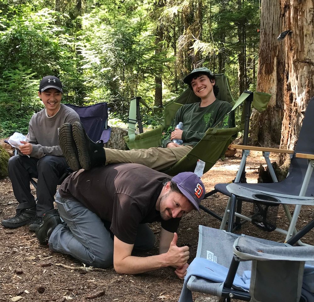
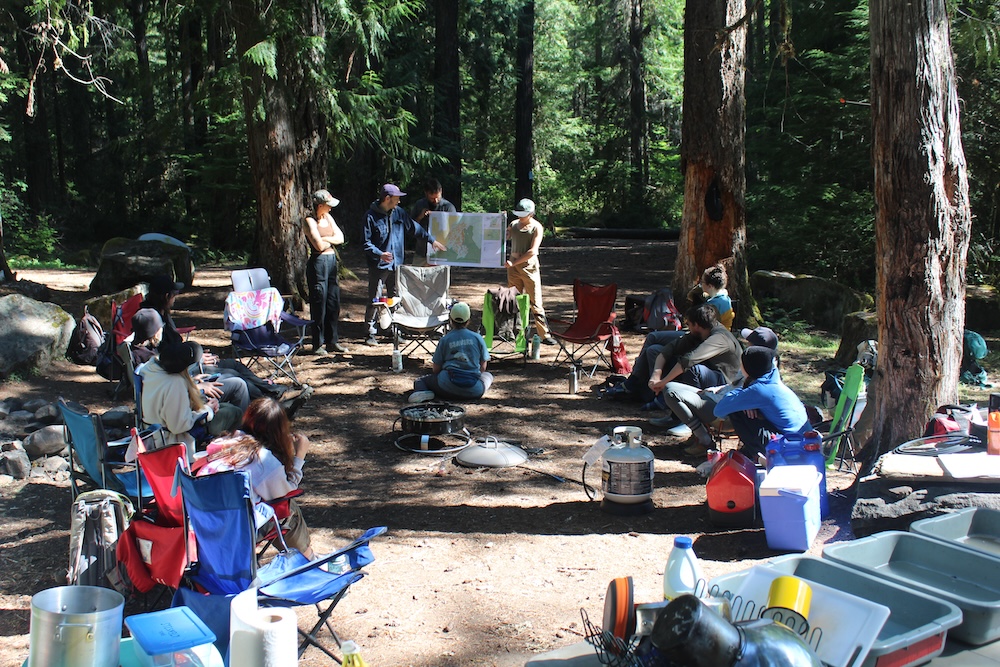
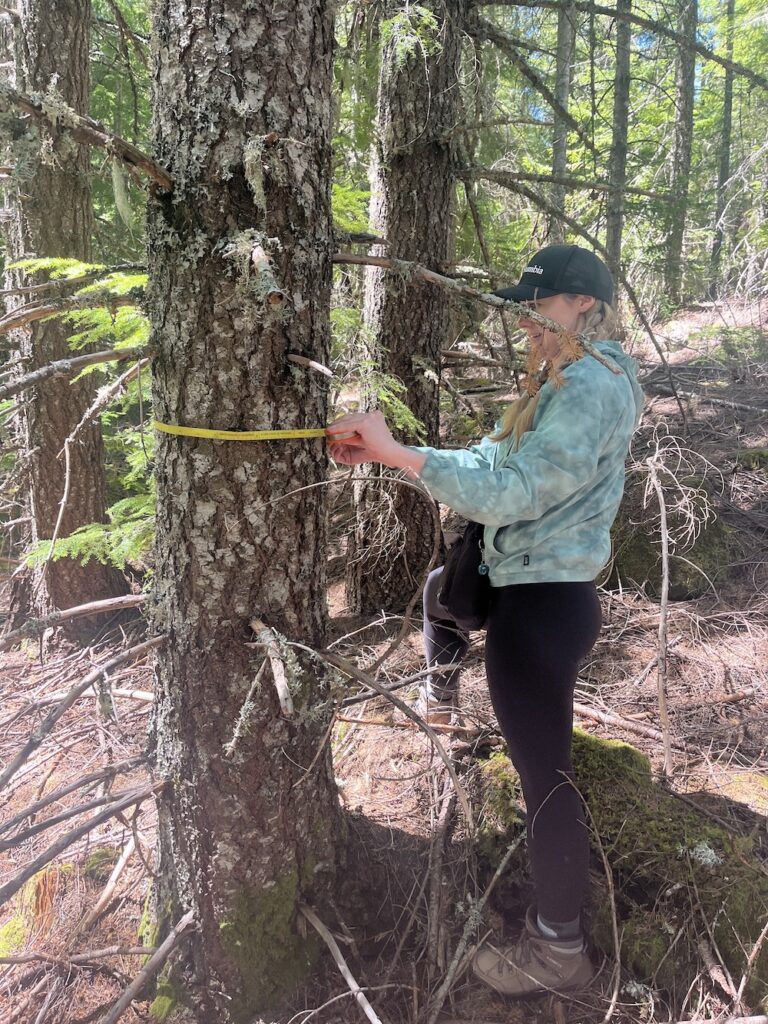
With active fires now burning across Mt. Hood NF, it’s hard to believe that just last month Bark staff and volunteers were camping along the Collawash River. We know we say this every time, but this was our best campout yet! Trying to find a dispersed campsite large enough for 30 people was challenging. But once we’d secured a campsite, we spent our days surveying the Nohorn Project area—documenting proposed logging units, wetlands, beaver habitat, and other features that may not show up on Forest Service maps—and our evenings cooling off in the river.
The Nohorn area is steep, wet, and full of seeps, springs, and small wetlands. The southern and eastern parts of the project area are bordered by the Opal Creek and Bull of the Woods Wilderness areas, and to the west is the Forest boundary and adjacent BLM lands. This less visited area of the Forest was heavily logged in the second half of the 20th century, leaving behind a patchwork of former clearcuts and winding roads. Some of the roads in the project area are now in poor condition due to unstable slopes and abundant water, and Bark’s Forest Watch Manager, Jordan, is concerned that reopening or rebuilding these roads to access the project area could be costly and damaging.
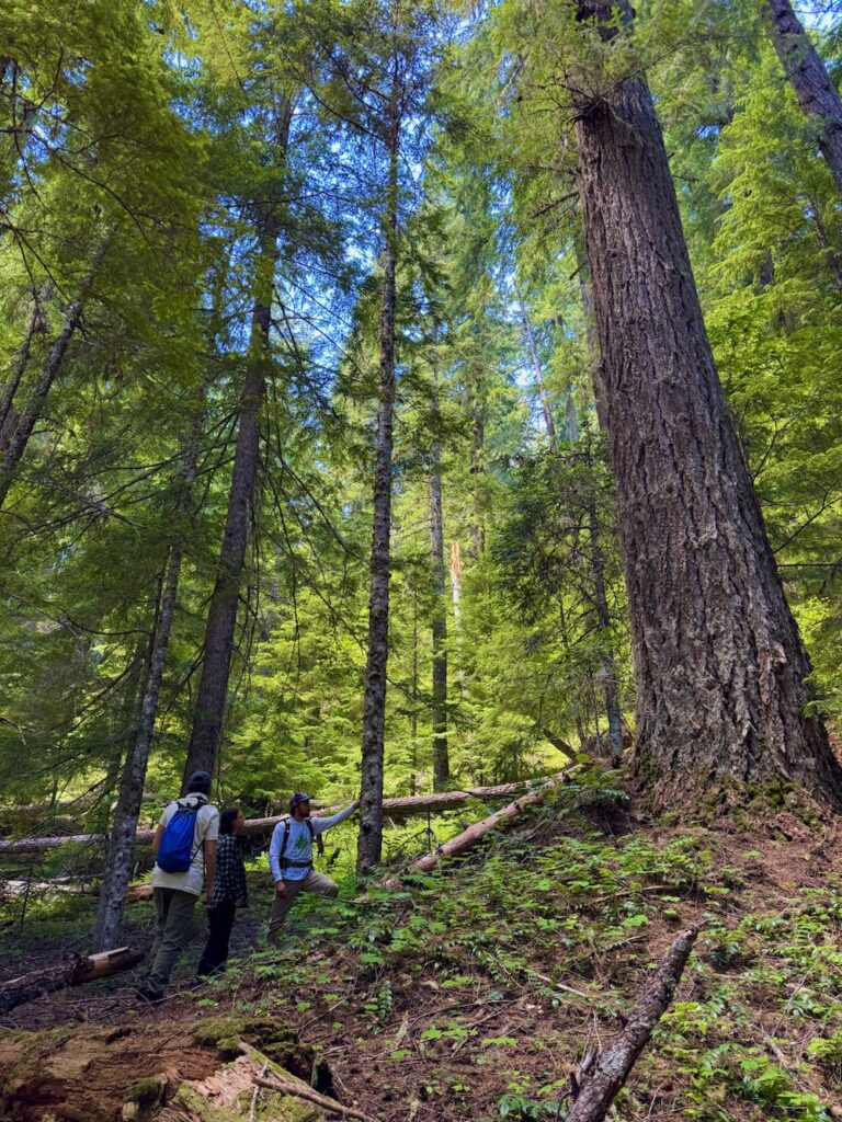
There are also still large areas of old growth within the project, and the southern portion of the project area is in a Late Successional Reserve (LSR), which means it’s supposed to be managed to maintain and enhance forests with old growth characteristics. While none of the old growth areas are proposed for logging, Forest Service policy dictates that any logging/thinning in the LSR needs to be for restoration purposes, to accelerate the development of old-growth characteristics.
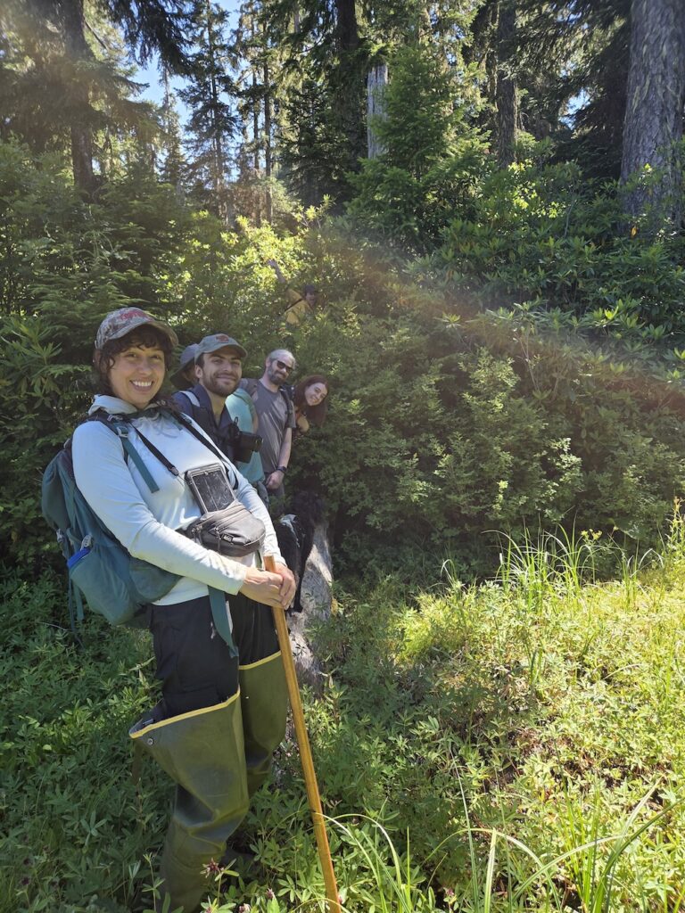
On the Restoration side, our surveys uncovered important habitat that deserves protection. The Hugh Creek Complex has two large ponds that are mapped and thus protected from Forest Service management. Bark staff and volunteers found old beaver chew and a dam that had created or expanded one of the large ponds. However, the wetlands surrounding the ponds are not mapped on the National Wetland Inventory or on Forest Service maps and therefore are at risk of being damaged during logging. We were able to map parts of the Hugh Creek complex in April of this year and mapped the rest during the July campout. This will allow us to expand the wetland zone and protect the sensitive habitat around the ponds.
We also identified a promising potential beaver relocation site at Lily Pad Lake, with deep water, abundant willow and alder, and plenty of aquatic vegetation. We’ll continue groundtruthing the Nohorn Project area (as fire conditions permit) to document mature and old-growth forests, steep slopes, unmapped wetlands, and other places where Forest Service maps don’t tell the whole story.
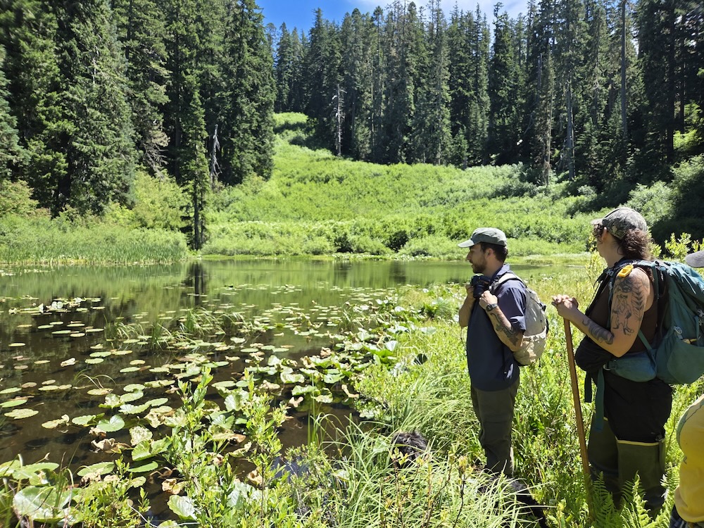
A huge thank-you to everyone who bushwhacked through brush, climbed steep slopes, and helped collect this data! Your fieldwork helps Bark, and the Forest Service, see what’s really on the ground. And it was a great opportunity to get to know our awesome community. If you didn’t make it out with us this time, there’s always next year! (Plus some field days in the meantime to tide you over.)
Updates on the Grasshopper Fire & a changing fire regime on Mt. Hood
Bark has been monitoring the Grasshopper Fire, which was first reported on July 23rd and likely started by a “lighting bust,” like many of the other large fires that have been impacting the PNW. Shifting winds have led to dramatic changes in the fire’s direction and behavior over a large and rugged area, and has burned multiple different forest types as a result. It started at about 4,800 ft in the mixed conifer forests that drape a portion of the east side of MHNF, and at first, progressed north into Badger Creek Wilderness and east, down slope into pine/oak savannah, forcing the evacuation of hundreds of people in the Sportsmans Park, Pine Hollow, and Wamic communities.
Then around the middle of last week, east winds from the dry hot interior of the continent pushed the fire westward over the Cascade crest, into high-elevation forest, and down towards the Highway 35 corridor. For a moment it seemed that the SE flank of Mt. Hood could be threatened, but fortunately a combination of higher fuel moistures and dying winds kept that from happening.
Then the winds shifted back westward, driving the fire back to the east, across the upper Dog River watershed, Fifteenmile Creek, and down into the pine oak foothills where it is once again threatening homes and communities to the north and south of Friend Road. At the time of writing, the fire is at 85,114 acres and 20% containment. Many beloved places have been affected: the fire has burned much of Badger Creek Wilderness, including Badger Lake and the historic Flag Point Lookout.
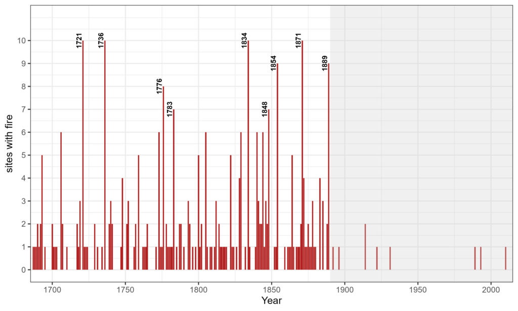
Fire itself is not unusual on this landscape. Recent fire history research on Mt. Hood shows that historically, similarly sized fires occurred in this area 3-4 times per century. But this fire is burning in very different conditions than those of historical fires. Climate change, development, fire exclusion, clearcut logging, and the forced removal of Indigenous peoples and their burning practices have all altered the forest structure and thus fire behavior. As you can see from the graph below, fires that once burned frequently and helped shape forest structure and species composition have largely been suppressed for over a century. In fact, after 1890, frequent low- and moderate-severity fire essentially disappeared from the landscape.
What comes next?
Once the fire is contained, a Burned Area Emergency Response (BAER) team will assess soil and vegetation impacts, infrastructure, and recreation sites. We can expect proposals for hazard-tree removal, salvage logging, recreation-site reconstruction/rehabilitation, reforestation, and rehabbing all the dozer lines and impacts from heavy machinery used in suppression operations. The fire has also impacted five previously signed NEPA decisions: Rocky, South Pen, Grasshopper, 27 Road, and Hootnanny. Because the fire changed the conditions that the Forest Service (FS) analyzed in the original environmental analysis, the FS will need to reevaluate impacted portions of the projects and potentially develop new, supplemental NEPA analyses.
These are still early days for this fire, and Bark will continue to monitor the situation on the ground and stay involved in future conversations about the recovery and stewardship of the impacted areas.
For the latest updates on the Grasshopper Fire, check out the Grasshopper Fire Facebook Page. We’re also monitoring this and other fires that have sparked in MHNF in recent days on the nonprofit app, Watch Duty.
Updates on H.R. 655 + Zany Bits demonstration later today!
Thanks to all the Bark supporters who took action on HR 655! 384 letters were submitted to the Senate Subcommittee on Public Lands, Forests, and Mining, urging lawmakers to reject this bill.
ICYMI: HR 655 would transfer 150 acres of Mt. Hood NF to the City of The Dalles to facilitate an expansion of its reservoir. The proposed expansion is tied to growing water demand in The Dalles—including from major industrial users like Google data centers—and could increase pressure on the Dog River and the fish & wildlife that depend on it.
That’s why Zany Bits, a street theater group affiliated with XRPDX, is holding an event outside Senator Ron Wyden’s Portland office TODAY from 4-5 pm to urge him to stop HR 655.
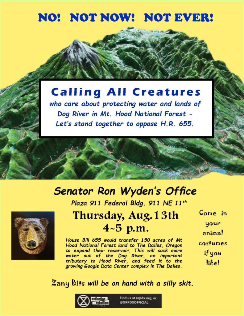
Bark staff will be there to voice our opposition to the bill. If you can join, please do! We need a big turnout to show Sen. Wyden that Oregonians are paying attention, and that handing over public lands for private water interests is not okay.
Tell Sen. Klobuchar to Oppose Forestry Provisions in Senate Farm Bill
Earlier this year, Bark joined over 200 organizations from across the country in signing onto a letter to Congress expressing opposition to the 2026 House Farm Bill. Now, a version of that bill is being marked up in the Senate, and this version still contains many of the same harmful forestry provisions, cuts to conservation programs, and other poison pills. Republicans are trying to use the forestry provisions in Title VIII of the bill as a vehicle for deregulation and handouts to the timber and biomass industry. Sweeping proposals would establish broad exemptions from environmental review, limit public input on massive projects, potentially increase wildfire risk, and threaten endangered species and our natural resources, including our drinking water.
Let Ranking Member Sen. Amy Klobuchar (D-MN) and the other Democrats on the Senate Agriculture Committee know that this bill is incredibly dangerous to farmers, families, and the environment! If all the Dems oppose the bill, it won’t make it out of committee.
Staff Contacts:
Amy Klobuchar, Ranking Member, D-MN (Phone: 202-224-3244)
- Committee Staff: Mike Schmidt, Senior Adviser mike_schmidt@ag.senate.gov; Alex Noffsinger, Senior Professional Staff Member alex_noffsinger@ag.senate.gov
- Ag: Baz Selassie, Legislative Director baz_selassie@klobuchar.senate.gov
- Public Lands and Natural Resources: Chris Clark, Brookings Institution Legis Congressional Fellow christopher_clark@klobuchar.senate.gov
Thanks for standing with Warm Springs!
Thanks to everyone who responded to our call for support of The Confederated Tribes of the Warm Springs’ (CWTS) Wildfire Recovery Fund! We’re pleased to report they have now surpassed their fundraising goal. And thanks to generous in-kind donations by our supporters, Bark was able to deliver approximately 575 lbs of food, water, masks, and sanitary items to CTWS on August 7th.


In case you missed it, you can still make a donation to support CWTS’s ongoing recovery efforts on their official donation page. Priorities for in-kind donations (as of 8/2) include:
- Bottled water
- No-cook food items
- Battery-powered lanterns
- Personal hygiene items (soap, lotion, new socks, washcloths, towels, toothbrushes, toothpaste, menstrual products)
- Small power banks and propane stoves
- Pet food and horse grade hay
- Childcare items, especially diapers and wipes
- Gift cards and hotel donations
- Small fans, box fans and filters
- N-95 masks
- Blankets & pillows
More information is available here.
News We’re Following
- 6 houses burned, 200 buildings threatened by Grasshopper Fire near Mount Hood // OPB
- This is a developing story. Stay tuned, as conditions can shift quickly.
- Trump-backed preservation overhaul approved by federal council // E&E News by POLITICO
- This proposal would radically restructure Tribal consultation and take away opportunities Tribes currently have to offer real input while restricting the places that can be protected, the kinds of harms that can be considered, and the types of actions that can be taken to protect places from destruction. Read the Advisory council’s draft Notice of Proposed Rulemaking here.
- A 30-day comment period is expected once the Notice has been published in the Federal Register. Stay tuned.
- “Six ways advocates and organizations can practice solidarity for environmental justice” // resilience
- This article by former Bark Board member and long-time ally, Dr. Sarah Wald, and her colleagues & students lays out six ways that environmental and land-use advocates/orgs can support environmental justice groups and causes.
- Oregon Establishes Natural and Working Lands Net Carbon Sequestration Goals // Oregon Department of Energy
- The Oregon Climate Action Commission has adopted new net sequestration goals for Oregon’s natural and working lands: at least 57.6 MMTCO2e per year across all land categories by 2035, and at least 62.4 MMTCO2e per year across all land categories by 2050. Key quote: “The goals, while voluntary, set a guidepost for considering land management and stewardship as part of Oregon’s ongoing climate action — and they are critical…Oregon’s lands can help at a scale no other carbon removal technologies have achieved yet.”