Immemorial Mt Hood
The 1.1 million acres now known as the federal public lands of Mt. Hood National Forest are, in fact, rightfully the territory of Indigenous nations and the homelands of the Wishram, Wyam, Tenino, Walla-Walla, Wasco, Clackamas, Molalla, Taih, Chinook, Paiute, Kalapuya, and many other Indigenous nations.
The Warm Springs Treaty of 1855 and the Willamette Valley Treaties dismantled the Indigenous world and installed settler-colonial dominance across the landscape. The Mt. Hood National Forest shares a border with the Warm Springs Reservation. Tribes were barred from crossing this border in a duplicitous “supplemental treaty”, created in 1865 and which was only officially nullified in 2020.
Bark encourages you to dedicate your time and effort to learning about the true history of these stolen lands. Bark has provided an introductory list of Native authors, speakers, academics, artists, and activists that have informed its work.
David G. Lewis, PHD (Confederated Tribes of Grande Ronde – Santiam, Chinook and Takelma)
Dina Gilio-Whitaker (Colville Confederated Tribes)
Mark Charles (Diné)
Dr. Kyle Whyte (Potawatomi)
Dr. Robin Wall Kimmerer (Potawatomi)
Vine Deloria Jr. (Standing Rock Sioux)
Deborah Miranda (Ohlone Costanoan Esselen/Chumash)
Dr. Jeanette Armstrong (Syilx Okanagan)
Ernestine Hayes (Tlingit)
Walter Echo Hawk, Sr. Esq. (Pawnee)
Kathleen Shaye Hill, J.D., LL.M. (Klamath)
Honorable Alfred Lane, III (Confederated Tribes of Siletz Indians)
Dr. Phillip Cash Cash (Cayuse, Nez Perce)
Elizabeth Woody (Confederated Tribes of Warm Springs, Yakama, Navajo)
Robert J. Miller (Shawnee)
Dr. Kaitlin Reed (Yurok/Hupa/Oneida)
Colonization and Mt. Hood
European colonizers, settler-colonial communities, and the U.S. federal government have waged a centuries-long war of legalized genocide, land theft, and cultural erasure against Native people. This is perpetuated through modern law and policy which assert non-Native control over the stolen land.
Beginning in the 1100s, Christian, European countries were instructed by the pope of the Catholic Church to invade non-Christian nations around the world, conquer and enslave the people, and steal their lands and resources. The European nations invented an “international law” to justify this brutal effort called the “Doctrine of Discovery”. In the early 1800s the Doctrine of Discovery inspired the Monroe Doctrine, which declared U.S. superiority over the entire western hemisphere and created Manifest Destiny: a religious concept that justified U.S. Westward expansion. The Doctrine of Discovery was written into the legal system of the U.S. through acts of Congress, Supreme Court rulings, in treaties, and land sales that the U.S. made with other colonizing European governments which had claimed land on the continent. The Doctrine of Discovery has not been renounced by any nation and remains the foundational law of the U.S., Canada, and other colonial states. The doctrine has been cited by the U.S. Supreme Court as recently as 2005, in City of Sherrill v. Oneida Indian Nation of New York. Writing for the majority, Ruth Bader Ginsburg stated that “Under the ‘doctrine of discovery…’ fee title [ownership] to the lands occupied by Indians when the colonists arrived became vested in the sovereign—first the discovering European nation and later the original states and the United States.”
To encourage white, colonial settlement in Oregon territory, the U.S. Congress passed the Oregon Donation Lands Act in 1850. The Act granted 320 acres of designated areas free of charge to every unmarried male citizen of European descent, aged eighteen or older–or 640 acres to every married couple–arriving in the Oregon Territory before December 1, 1850.
However, “extinguishing Indian title” was the first step to entitling “Oregon” land to the white, settler-colonial families who would found the state. Before Congress voted for the Donation Lands Act in 1850, it passed legislation authorizing commissioners to negotiate treaties to extinguish Indian title, forcibly remove Native communities, “and leave the whole of the most desirable portion open to white settlers.” By stealing Indian land through the treaty process, much of Oregon was made part of the public domain and claimed by white settlers under these early federal land laws.
For Native people in Oregon’s three major western valleys (Willamette, Umpqua, and Rogue), the Donation Lands Act was an act of theft and genocide, resulting in their forced relocation to the Siletz and Grand Ronde reservations. These two reservations were established by the executive order of the U.S. President and were not subject to treaty stipulations.
The architect of the coastal reservations was Oregon Superintendent of Indian Affairs, Joel Palmer. He justified the reserves by arguing that they were isolated and away from the Willamette Valley, inaccessible by sea, and lacked agricultural potential.
In 1855, Joel Palmer also negotiated a treaty that established the Warm Springs Reservation. Under the treaty, the Wasco, Columbia River, Oregon Territory with the Taih, Wyam, Tenino, & Dock-Spus Bands of the Walla-Walla, and the Dalles, Ki-Gal-Twal-La, and the Dog River Bands of the Wasco relinquished approximately ten million acres of land, but were reserved the Warm Springs Reservation for their exclusive use. This reservation now borders much of southeastern part of Mt. Hood National Forest.
After Indian title was extinguished, and the lands were surveyed, the General Land Office could issue a final certificate that authorized issuance of a land patent to transfer title to a settler (Maybe one of your ancestors? You should check!). A total of 7,437 land patents were issued under the law.
First Forest Reserves in Oregon
The first attempt to use the law in Oregon was by the City of Portland. In the early 1890s, Henry Failing, chair of the Portland Water Commission, asked that a forest reserve be created around the new municipal watershed. The Bull Run Forest Reserve, covering 142,080 acres, was established by presidential proclamation on June 17, 1892. It was the first forest reserve in Oregon.
The Cascade Range Forest Reserve was created on September 28, 1893, and was managed by the General Land Office. Encompassing 4,492,800 acres and 235 miles in length, the Cascade Range Forest Reserve was the largest forest reserve in the nation.
With this conservation came petitions to dismantle the reserve in 1895-1896. The protests were primarily from sheep owners in north-central Oregon, a few homesteaders in or near the reserve, and miners in the Bohemia Mining District. The entire Oregon congressional delegation was ready to eliminate or severely reduce the Cascade Range Forest Reserve, but instead buckled to public pressure to keep the reserve intact.
Congress transferred all forest reserves and their management to the Department of Agriculture on February 1, 1905, where they were managed by Gifford Pinchot, head of the newly-created U.S. Forest Service. The United States Forest Service (USFS) was created on July 1 by making a simple name change from the Bureau of Forestry.
Soon thereafter, U.S. Senator Charles W. Fulton of Oregon introduced an amendment to a bill that would eliminate the President’s authority to establish national forests in Washington, Oregon, Idaho, Montana, Wyoming, and Colorado. Only Congress would be allowed to establish forest reserves in those states. The amendment also changed the name of the forest reserves to national forests in order to make it clear that the forests were to be used, not preserved.
After the transfer of federal forests to the U.S. Forest Service in 1905, the Bull Run Forest Reserve had become the Bull Run National Forest on March 4, 1907. On July 1, 1908, the entire forest was combined with part of Cascade National Forest to establish the Oregon National Forest and the name was discontinued.
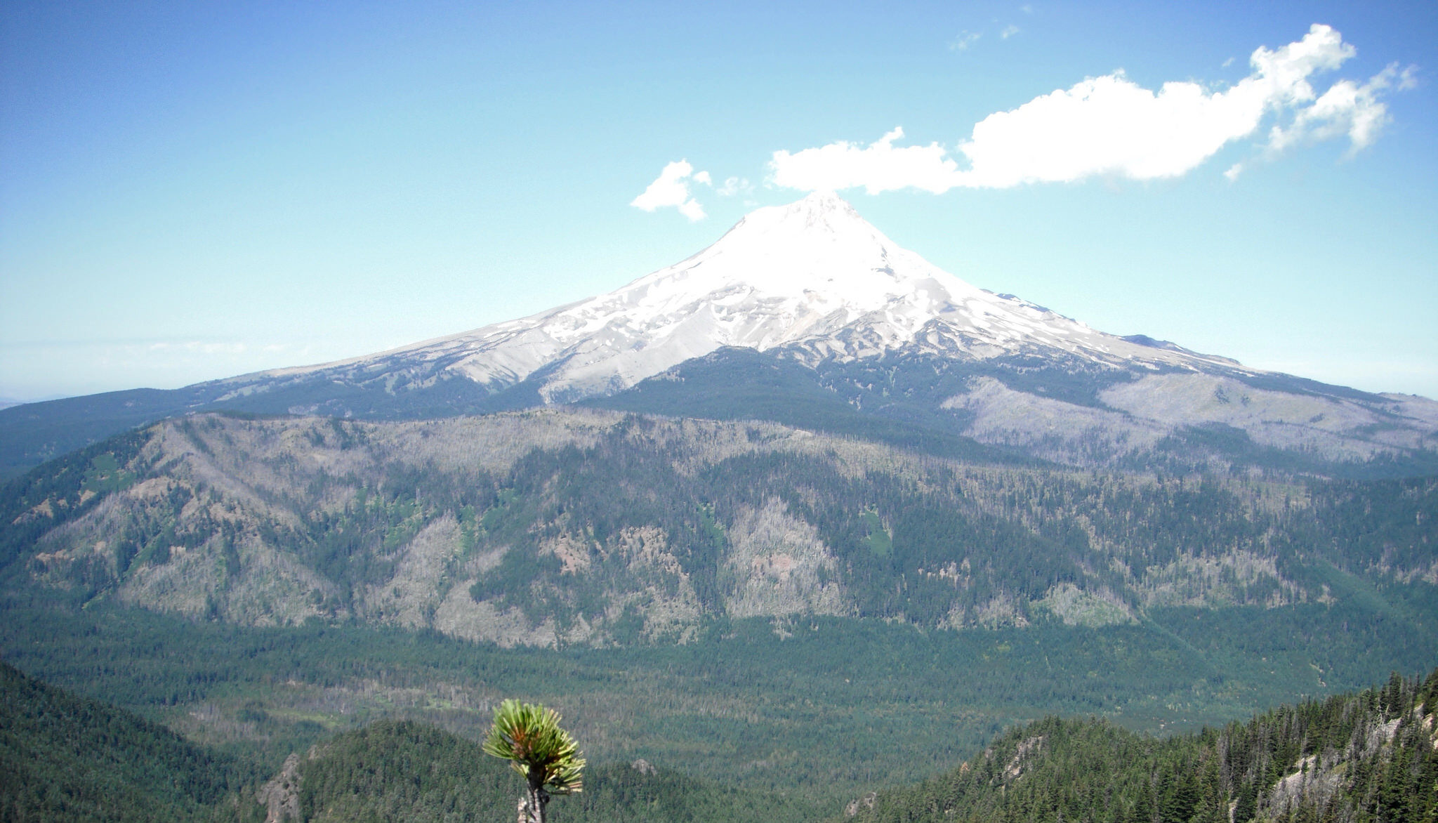
On January 21, 1924, the Oregon Forest was renamed Mount Hood National Forest.
Mt. Hood Today
Today, the U.S. Forest Service recognizes Mt. Hood National Forest as an urban national forest due to its position just east of the Portland/Vancouver metropolitan area. Its “urban” status means that many locals regularly visit the Forest and care about how it is managed. Many area residents also engage directly with the Forest Service in the agency’s stewardship of this place, more so than with other national forests.
The Forest Service acknowledges that recreation opportunities and drinking water are the Forest’s two primary resources. Mt. Hood National Forest receives over four and a half million visitors each year and “[n]inety-eight percent of the Forest is somebody’s municipal water supply.” The Forest provides a domestic water supply for 1.1 million people as well as an industrial supply for numerous businesses and enterprises. The Forest also provides critical freshwater habitat for a suite of aquatic species, including culturally-iconic salmon, and steelhead. Although many salmonid runs are protected under the Endangered Species Act, all runs still contribute to local and regional economies through commercial and recreational fishing.
In 2019, local recreationists and visitors spent $601 million in the Mt Hood/Gorge Tourism Region. Spending on outdoor recreation in the Mt Hood/Gorge Tourism Region supported:
- 7,400 full and part-time jobs
- $281 million in wages and other compensation
- $293 million in GDP contributions, and
- $36 million in state and local taxes.i
Mt. Hood National Forest is managed by the U.S. Forest Service according to numerous laws and policies such as the NW Forest Plan, Mt. Hood Forest Plan, Aquatic Conservation Strategy, Spotted Owl Recovery Plan, and the Sustainable Recreation Framework.