Given the scale of degradation within streams and wetlands and throughout
the West, we need all partners mobilized to restore these systems. Beavers are
our greatest ally. But for this ecosystem engineer to successfully create
resilience against drought & wildfire, they must be able to safely build
and maintain their natural infrastructure while expanding their numbers and
distributions across the state.
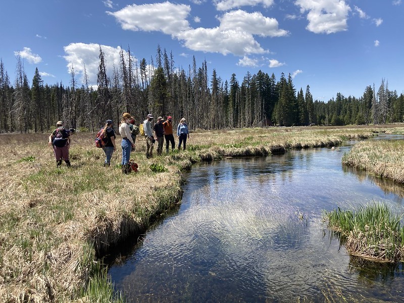
Beaver habitat field days are moderate to high physical activity days with
plenty of stepping over logs, wading into wetland areas and pushing through
shrubs. We’ll collect data along 200 meters of the stream channel (when we
have one) and assess our site for presence of woody debris, herbaceous foods,
hydrology, beaver sign and more! Our beaver scorecard will allow us to rank the
sites suitability for potential future beaver reintroduction. This data will
then be shared with the Forest Service, Oregon Department of Fish and Wildlife,
Institute of Natural Resources, Portland State University students and others.
We will all meet in Portland, OR at 9 am, coordinate carpooling to the site
location from there, and return in time to be at our meetup location between 5
and 6pm. Our final destination will be sent out via email prior to the
volunteer day.
This is an in-person event and will follow Bark’s COVID-19 volunteer work safety protocol.
Before registering: Everyone interested in participating in
Bark’s wetland mapping efforts is welcome! If you have wetland mapping
training, we’ll send you into the field to get started. If not, please review
Bark’s
online beaver
habitat survey training video (start at 48:30).
Questions? Visit Bark’s page on
what to expect on a volunteer day and
what to
pack for a field day for more information or email
Meg, Bark’s Field Survey
Coordinator, with additional questions.
Join us in finding suitable habitat to introduce beaver so we can get this amazing ecosystem engineer back on the landscape!