Action Alert: Protect Post-Fire Clackamas with Your Public Comment
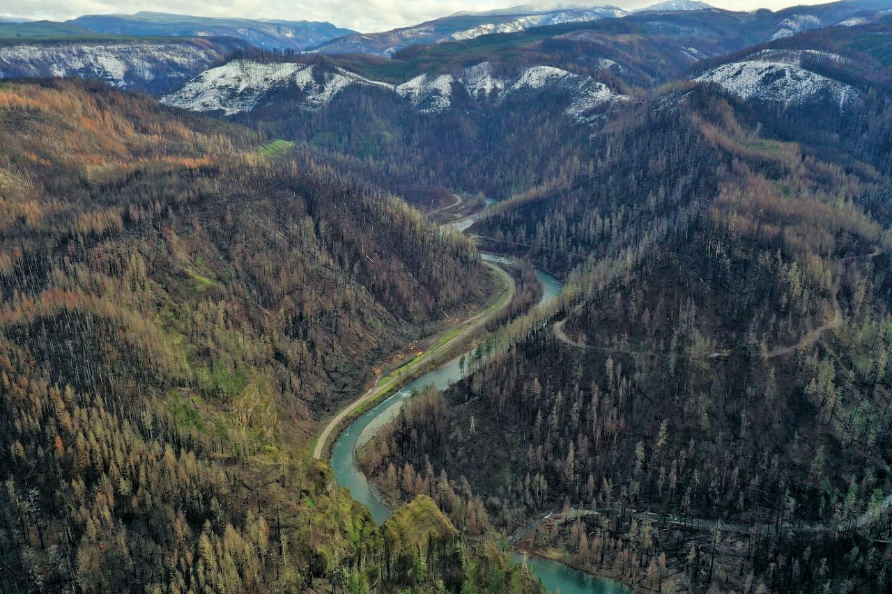
The Clackamas River basin has changed dramatically since the wind-driven Riverside Fire burned through the watershed in 2020. Thanks to robust public discourse and recent court rulings in the Willamette National Forest, the management of this sensitive post-fire landscape is finally receiving a full environmental analysis by the U.S. Forest Service and the time for public input is now.
We depend on the Clackamas watershed. Help shape its future!
It’s been a long time since the general public has had access to the Clackamas River basin, and after many months of work mitigating safety hazards, Highway 224 is now open to Ripplebrook with very limited access off the main highway. The Clackamas Roadside Danger Tree environmental analysis proposes danger tree removal on 232 miles of these off-highway roads. We applaud the Forest Service’s detailed environmental analysis and incorporation of Bark’s and the public’s comments received during the scoping period. Bark will continue to follow this project closely to ensure that the Forest Service maximizes the retention of large trees and minimizes the road network to reduce impacts to fish and wildlife habitat, water quality, and more.
Submit your comment to help shape the Clackamas’ future by May 28th!
Although the Clackamas River basin you’ll see today is a changed landscape, it is one full of new habitat types, regeneration, and resilience. Post-fire landscapes provide a unique environment for plants, fish, wildlife, and people alike which we have always relied upon to coexist and thrive. This is why it is fundamental to minimize the impacts of post-fire management and let ecological processes prevail for a better climate future.
For the forest,
Cara Christofferson, Forest Policy and Advocacy Coordinator
P.S. Join us for a Native-centered and led storytelling event this Saturday, Owed to The Mountain. Tickets are free and spaces are limited!
Suggested Talking Points for Writing Your Own Comment
- The proposed danger tree removal should remain limited to dying danger trees that have a high probability of failure within 5 years and are within striking distance of the road. Trees that have a low probability of failure within 10 years should not be considered for danger tree removal.
- Due to large losses to northern spotted owl and red tree vole habitat the Forest Service should use it’s own reference materials for identifying trees for removal which indicates that Douglas Fir > 20” diameter at breast heigh should be retained so that they may become habitat trees for species such as northern spotted owl and red tree vole.
- The planning area hosts congressionally designated Wild and Scenic Rivers. All management activities within these river corridors must protect and or enhance the identified outstandingly remarkable values for those segments. We encourage the Forest Service to strictly follow danger tree criteria and project design criteria to minimize impacts in these areas.
- Maintaining access to cultural resources requires meaningful consultation with the Confederated Tribes of the Warm Springs and the Confederated Tribes of the Grande Ronde. Mt. Hood’s management plan provides direction on honoring treaty rights, and traditional areas that are covered by the American Indian Religious Freedom Act.