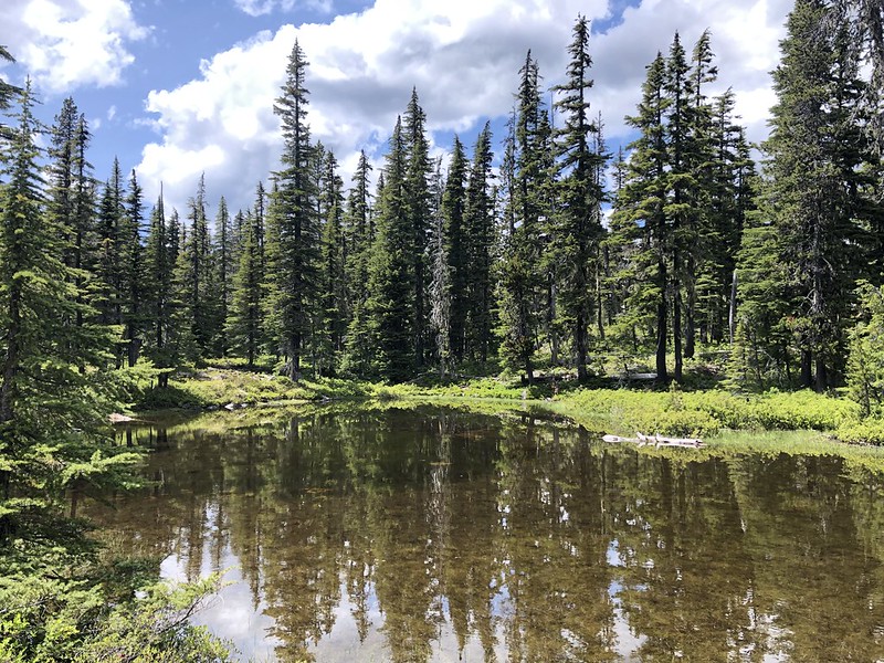
Wetlands serve many functions- from biodiversity hotspots, water storage and
filtration, aquifer replenishment, wildfire breaks and more. However, wetlands
are also notoriously tricky to map, and you can’t protect an ecosystem you
don’t know is there! Join us as we gather data about soils, plants and
hydrology to assist our wetland partners in mapping wetland areas on Mt.
Hood.
Wetland field days are moderate to high physical activity days with plenty
of stepping over logs, wading into wetland areas and pushing through shrubs.
We’ll walk the boundaries of our wetland maps to verify if the boundaries shown
on the aerial imagery maps match what we see on the ground. To do this, we’ll
identify wetland indicator plants, create data points for areas that are more
wet or dry than we expect and do a thorough soil sample. This data is then
shared with our wetland scientist partner Kyla Zaret to help her update wetland
maps in the Clackamas drainage basin. This data fits nicely into the larger
goal of estimating water storage capacity of individual wetlands in order to
further understand the effects of climate change on these sensitive ecosystems.
Given the scale of degradation within streams and wetlands and throughout
the West, we need all partners mobilized to restore these systems. Beavers are
our greatest ally. But for this ecosystem engineer to successfully create
resilience against drought & wildfire, they must be able to safely build
and maintain their natural infrastructure while expanding their numbers and
distributions across the state.
Beaver habitat field days are moderate to high physical activity days with
plenty of stepping over logs, wading into wetland areas and pushing through
shrubs. We’ll collect data along 200 meters of the stream channel (when we
have one) and assess our site for presence of woody debris, herbaceous foods,
hydrology, beaver sign and more! Our beaver scorecard will allow us to rank the
sites suitability for potential future beaver reintroduction. This data will
then be shared with the Forest Service, Oregon Department of Fish and Wildlife,
Institute of Natural Resources, Portland State University students and others.
We will all meet in Portland, OR at 9 am, coordinate carpooling to the site
location from there, and return in time to be at our meetup location between 5
and 6pm. Our final destination will be sent out via email prior to the
volunteer day.
This is an in-person event and will follow Bark’s COVID-19 volunteer work safety protocol.
Before registering: Everyone interested in participating in
Bark’s wetland mapping efforts is welcome! Please review Bark’s
online wetland mapping training materials before
attending a field day.
Questions? Visit Bark’s page on
what to expect on a volunteer day and
what to
pack for a field day. For more information or email
Meg, Bark’s Field Survey Coordinator,
with additional questions.