Anvil Vegetation Management Project
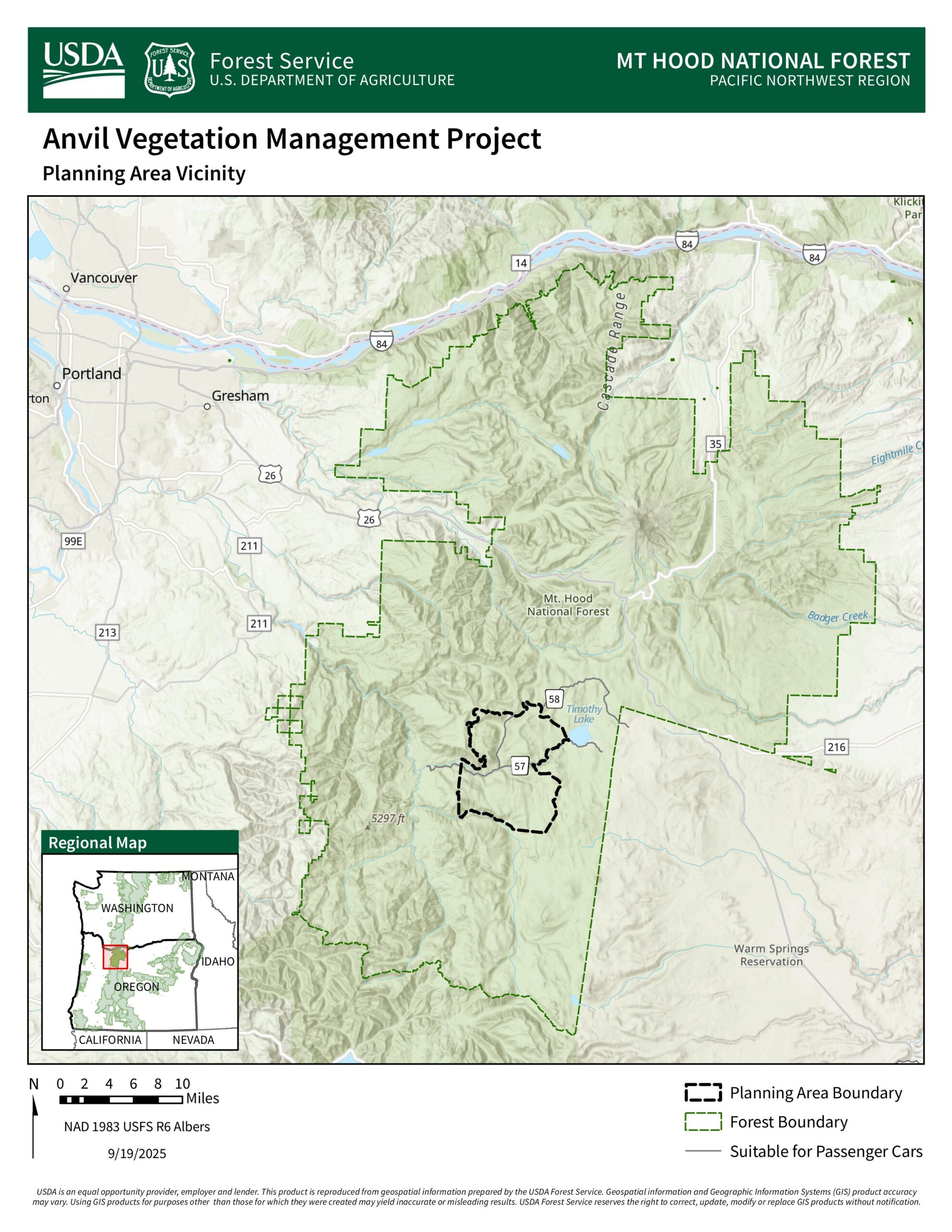
The Anvil Vegetation Management Project is in the Clackamas River Ranger District and includes approximately 4,000 acres slated for commercial logging and non-commercial fuels reduction work.
Status Updates
Bark’s analysis of the Forest Service’s documents are complete, though information on this page may change.
The Draft EA (being called a Preliminary Assessment) has been published and a 30-day comment period is now open. Because the Anvil project is being analyzed under the Emergency Action Determination, they are required to offer a comment period, though the law does not state how long the comment period must be. In our conversations with Mt Hood leadership, we have continued to advocate for meaningful comment period, and we are glad to see a 30-day comment period for this project. The comment deadline is June 19th at 11:59pm. Submit your comment here! See below for more information about this project and ideas for your comment. Comment guidelines can be found at the end of this page.
About the Anvil Project
This project proposes:
- 2,053 acres of commercial thinning/logging in historic clearcuts/plantations under 80 years old.
- 1,499 acres of roadside fuels reduction along roads 57, 5720, 5730, 58, and 5830, extending up to 150 feet from road edges; removes trees ≤10″ DBH while retaining larger trees and overstory canopy.
- 942 acres of prescribed fire, applied under controlled burn-plan conditions to mimic low- to mixed-severity fire regimes.
- ~7 miles of temporary road construction (6.6 miles on existing old road footprints, ~0.5 miles newly constructed). Rehabilitated after use
Anvil Project Proposed Action Map
Bark’s Engagement & Impact
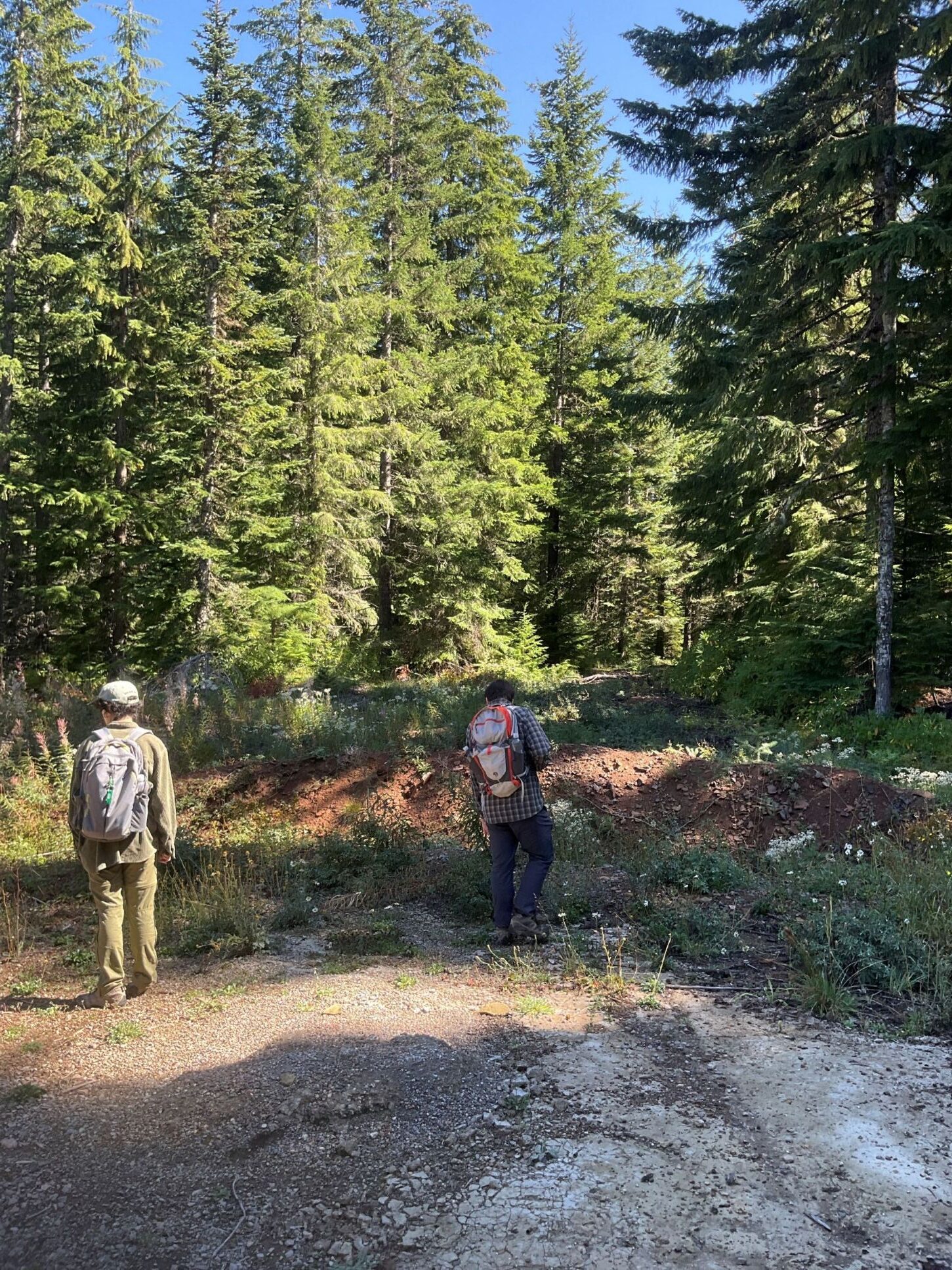
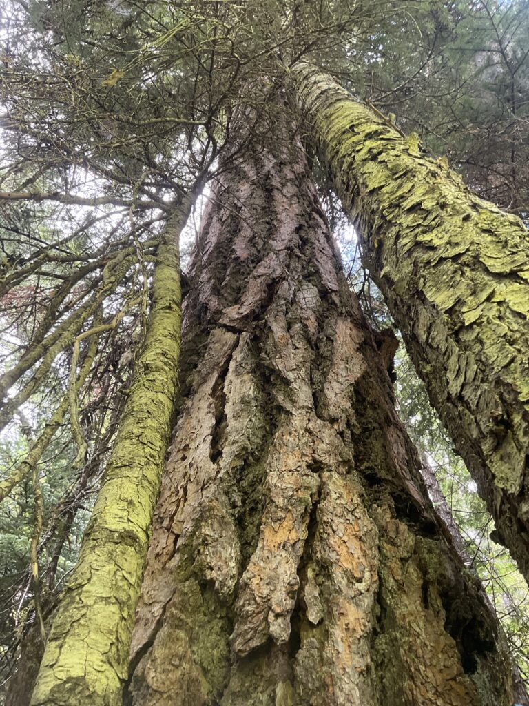
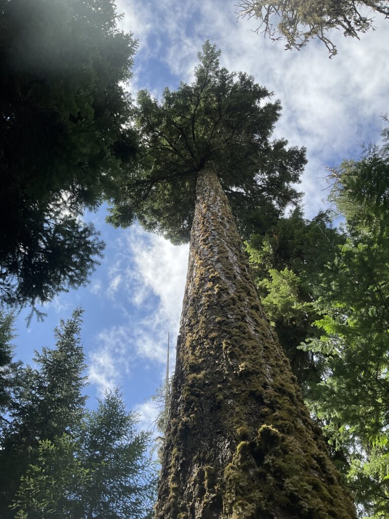
Long before this project was publicly announced, Bark received preliminary maps of the project area. This allowed Bark staff and volunteers to groundtruth the proposed Anvil project area in Summer 2025. We found many units containing mature and old-growth forest, as well as problematic road segments, hydrological issues, and areas where road infrastructure was altering natural water flow.
Bark and volunteers submitted our comments about the Anvil project in October 2025.
Our early engagement had a measurable impact on project direction and priorities – many of the units on the early maps we had concerns about, like areas with mature and old-growth forest, and unmapped seeps and springs, had been dropped thanks to our advocacy efforts.
Bark’s Concerns About the Anvil Project
Bark rejects the need for Emergency Action and has been actively pushing back against the Forest Service’s use of Emergency Action Determinations more broadly.
Since Trump loyalist Brooke Rollins took control of the Department of Agriculture, the agency has been hard at work slashing environmental review, cutting public oversight, and pressuring Forest Service staff to speed up timber sales. She’s declared an “emergency” on 60% of National Forest lands—using that label to fast-track logging projects with little to no environmental analysis or public input
Bark rejects the need for Emergency Action and does not support the use of Section 40807 of the Infrastructure Investment and Jobs Act (IIJA). The Mt. Hood Forest Service has cited two primary reasons for applying the Emergency Action Determination to the Anvil project: uncharacteristically severe wildfires and insect and disease outbreaks. But neither of these reasons hold up under closer inspection.
The Anvil project area is within moist, western Cascades Douglas-fir and western hemlock dominated forests. The Anvil Public Engagement Letter states: “Historically, frequent low- to mixed-severity fires maintained open forest structure and species composition in this area.” This statement is incorrect. While low to mixed severity fires played an important role in creating and maintaining structural diversity and species composition, high severity fires did as well. “Fire history studies and observations of early 20th century fires indicate that large, infrequent high-severity fires are characteristic of historical fire regimes in mountainous areas of the westside”.
As outlined above, Secretary Rollins’s Memorandum 1078-006 states uncharacteristically severe wildfires as one of the reasons the Emergency Action Determination is warranted and needed. The Secretary also claims that “too little active management” has compounded the issue. In the Anvil project area, we reject this reasoning. As you are well aware, the Clackamas River Ranger District was significantly impacted by the Riverside Fire in 2020. Though there is no denying the significant impacts of this fire, “Early records and 20th-century maps of burned areas indicate that the 2020 fires were not unprecedented in size and severity, and either burned within, or in close proximity to, areas that burned in large fires following European colonization.”
However, to explore the argument that Emergency Actions are warranted to prevent uncharacteristic fires in the Anvil project area, let us assume that the 2020 Riverside Fire was uncharacteristically severe. Even then, the actions proposed by the Anvil project would do nothing to prevent a similar fire in the future. “The influence of forest management on fire severity was minimal and variation in forest structure or fuels played relatively little role. These results provide little evidence to support the use of fuel treatments to mitigate fire severity under extreme fire weather conditions on the westside”. Further, “…our results suggest that manipulation of stand structure is unlikely to mitigate fire effects in wind-driven fires on the westside given the minimal differences in burn severity among stand structure classes”.
Finally, commercial thinning of plantations is not one of the authorized emergency actions to respond to emergency situations, yet the Forest Service is still applying the EAD broadly to the entire project. We feel that this is an illegal and inappropriate interpretation of the EAD.
Botanical surveys in roadside fuels units were not completed.
In the EA, the Forest Service states that, “We were unable to thoroughly survey roads planned for fuels reduction (i.e., shaded fuel break) treatment due to insufficient time.” (Botany report p. 6)
The Forest Service will be relying on sale layout staff and contractors to identify and buffer any rare and sensitive plants. This is a conflict of interest.
Additionally, roadside fuels treatments, especially in forests over 80 years old, should not be implemented until these botanical surveys are completed.
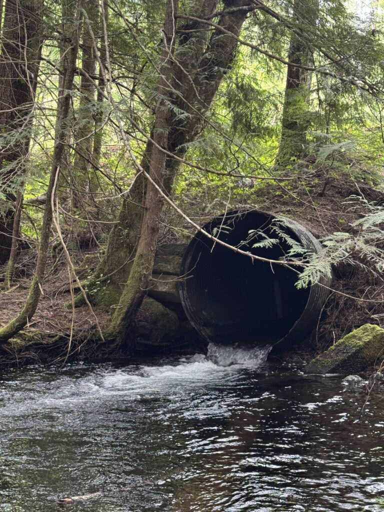
The Road 4600 perched culvert is blocking fish from accessing ~.8 miles of critical habitat, but the Forest Service isn’t planning to address it.
Objective 2 of the Aquatic Conservation Strategy (ACS, part of the Northwest Forest Plan), is to “maintain and restore spatial and temporal connectivity within and between watersheds.” The fisheries document claims that this project maintains existing connectivity, but that only partially meets objective 2.
The FS should analyze a proposed action to replace this culvert to allow listed fish species to access critical habitat

Other Road Issues
The Forest Service is not proposing to make any changes to roads in the project area. There are multiple segments of roads that are currently open and will be used for timber haul, but that should be closed or decommissioned.

The above road information is from pages 9-14 of the transportation report. ML stands for “Maintenance Level”, which refers to the Agency’s internal road classifications. An Objective ML of 1 means that the road should be closed to the general public. Decommissioning means that the road would be obliterated and would no longer exist on the landscape.
Data We’ve Collected
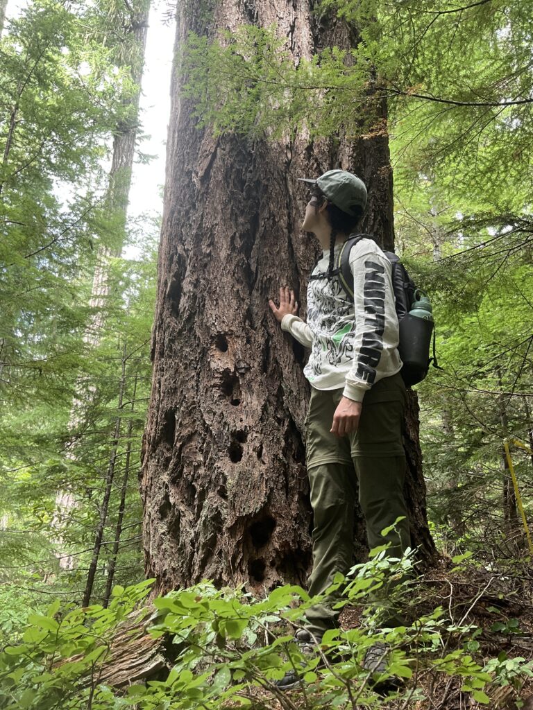
In the folder above you’ll find photos and track logs from groundtruthing surveys we did in the Anvil project area. You’ll also find KML/KMZ files, which you can open in Google Earth to view our tracks and photo points!
Comment Guidelines
The comment deadline is June 19th at 11:59pm. Submit your comment here!
- Start with sharing a bit about yourself.
- Why do you care about Mt Hood?
- What is your connection to the Mt Hood, and more specifically, do you have any personal connection or experiences with the project area?
- What do you value about Forests?
- Tie some of your personal connection to Mt. Hood into your more specific comments and questions about the project’s proposed actions.
- Here are some questions you may include in your comments about Authorized Emergency Actions (AEAs):
- What are the hazards threatening human health and safety?
- What kind of mitigation is the FS trying to achieve?
- Do all the proposed actions fit within one of AEA categories?
- Does commercial thinning fit under one of these descriptions?
- If not, does the FS explain why a proposed action not obviously on the list is an AEA?
- Are all the proposed actions being implemented “in order to achieve relief from hazards to human health and threats to natural resources”?
- Does the FS explain what the threat or hazard is and what kind of relief of mitigation will be achieved?
- How will the proposed actions achieve “relief from hazards threatening human health and safety and threats to natural resources”?
- Advocate for botanical surveys to be completed before roadside fuels treatments are done!
- Advocate for the Forest Service to analyze a proposed action to replace the road 4600 culvert to allow fish to access critical habitat!